Biking

Camping

Fishing

Hiking

Horseback Riding

Seasonal Hunting

Paddling
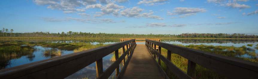
Tiger Bay State Forest was named after its largest physiographic feature, Tiger Bay, an extensive wetland that provides a critical aquifer recharge for the local area. Pine islands dot the extensive hydric swamp forest and comprise 40% of the property.
Also found in the forest are two lakes, Indian Lake and Scoggin Lake, and several ponds. Coon Pond is a natural water body, while Rattlesnake Pond, Woody Pond and Ranch Pond are man-made ponds that are available to the public for fishing. Three unnamed man-made ponds are also located in the forest.
Recreational activities include hiking, bicycling, horseback riding, picnicking, boating, fishing, hunting, nature study and photography. Horseback riding and bicycling are allowed only on forest roads, permanent firelines and designated trails.
Tiger Bay State Forest contains one hiking trail (Buncombe) in the Florida Forest Service's Trailwalker Hiking Program and one equestrian trail (Rima Ridge) in our Trailtrotter Program. The Pershing Highway Trail is a short scenic hike over a mile of brick road constructed in 1917. While riding our trails, please note that proof of current negative Coggins test is required for all horses in all Florida State Forests.
Camping is available at the semi-primitive campgrounds on Tiger Bay State Forest, one of which is the Tram Road Equestrian Campground on the Rima Ridge Tract. It features small corrals for horses and a non-potable water supply.
For hunting, Tiger Bay State Forest is managed as a Wildlife Management Area by the Florida Fish and Wildlife Conservation Commission (FWC). Indian Lake, Scoggin Lake and Rattlesnake Pond are open for fishing and small boat use. Hunting for white-tailed deer, hogs and small game is permitted during designated seasons.
In keeping with its mission to protect and manage Florida's forest resources, the Florida Forest Service has developed rules that apply to all State Forest visitors. Find out more about State Forest fees and rules.
Day use is from sunrise to sunset.
Florida Forest Service
4316 W. International Speedway Blvd.
Daytona Beach, FL 32124-2007
Primary Contact
(386) 317-3277
Email Tiger Bay State Forest
Secondary Contact
(386) 384-5256
Passes are no longer available at the State Forest office. To purchase a pass or make a reservation, visit ReserveAmerica or call 1-877-879-3859.
Tiger Bay State Forest is located in the central section of Volusia County, approximately 7 miles west of Daytona Beach. The forest extends north and south of U.S. Highway 92. Four forest access points are located off of U.S. Highway 92.
To access the Rima Ridge Tract, go 4 miles west of the I-95/U.S. 92 interchange on U.S. 92 and turn north onto Indian Lake Road for approximately 1.75 miles. This road takes you into the forest. Access to the Rima Ridge Tract is also available by taking State Road 40 approximately 5 miles west of I-95. The entrance is on the south side of the road.
The Dukes Island Road entrance leading to Rattlesnake Pond is 6 miles west of the I-95/U.S. 92 interchange on U.S. 92. The entrance is on the south side of the road.
The Old DeLand Road entrance is 7 miles west of the I-95/U.S. 92 interchange on U.S. 92. The entrance is on the north side of the road.
Tiger Bay State Forest's office headquarters is located on the north side of U.S. Highway 92, one-half mile east of the Old DeLand Road entrance.
The Clark Bay Road entrance is 8.5 miles west of the I-95/U.S. 92 interchange on U.S. 92.
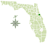
Total Acreage: 28,365
Counties: Volusia
Smart device mapping is possible and encouraged in the State Forests. Before visiting a forest, search for “PDF Maps” in the app store to find an app that works for you and download our State Forest map, which is georeferenced.
 1 MB
]
1 MB
]
Contact:
Justina Jones
Justina.Jones@FDACS.gov