
Biking

Primitive Camping

Fishing

Hiking

Horseback Riding

Seasonal Hunting

Picnicking
Etoniah Creek State Forest contains 8,902 acres of various natural communities. The forest was acquired as part of the Etoniah/Cross Florida Greenway Conservation and Recreation Lands (CARL) project. Etoniah Creek State Forest is named after Etoniah Creek, a stream that travels 2.5 miles through the eastern portion of the forest. The forest is managed by the Florida Forest Service under the multiple-use management concept to restore, protect and manage ecosystem functions while allowing compatible public uses.
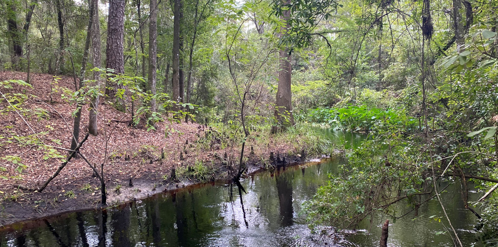
Located just to the south of the 819-acre Georges Lake, Etoniah Creek State Forest has 491 feet of lake frontage. Three shallow creeks (Falling Branch Creek, Etonia Creek and Rice Creek) meander through floodplain swamps and bottomland hardwoods.
The forest is home to a variety of wildlife and is part of a wildlife corridor that offers the black bear a vast roaming area, a necessity for its survival.
Other types of wildlife commonly found in the forest include white-tailed deer, bobcat, fox squirrel, wild turkey, eastern diamondback rattlesnake and barred owl.
Species found in the forest that are listed as endangered, threatened or of special concern include the eastern indigo snake, gopher tortoise, black creek crayfish and Florida scrub jay.
Etoniah rosemary (Conradina etonia) is an endangered plant that was first described in 1991 and is found mostly in scrub habitats. Etoniah Creek State Forest boasts the only known population of Etoniah rosemary found within Florida Forest Service lands.
Recreational activities in the forest include hiking, biking, fishing, hunting, nature study, wildlife viewing and photography. There is a designated trail for horseback riding, a 10-mile loop that traverses the east and west sides of Holloway Road. “From Highway 100 turn north on Holloway and continue 2.5 miles then turn east on to Field House Road. The Holloway Day Use Area/Trailhead will be on the right in a quarter mile.
Holloway Loop Trail is a designated Trailtrotter trail. Learn more about the Trailtrotter Program. Please note that proof of current negative Coggins test is required for all horses in all Florida State Forests.
Etoniah Creek State Forest contains three hiking trails. The George’s Lake Hiking Trail is a one-mile round-trip trail that takes visitors to an observation deck overlooking George’s Lake. Lake Blossom Trail is a short half-mile loop trail around a beautiful grassy pond. This area provides a great opportunity for birding and photography. The George's Lake and Lake Blossom trails are part of the Trailwalker Program. The third trail is the Longleaf Pine Trail, which follows part of the Florida National Scenic Trail and leads hikers to a healthy population of Etoniah rosemary at the southern end of the trail.
The Palatka-to-Lake Butler State Trail, a Florida Rails-to-Trails project, crosses the south side of the forest. The project converted an old railroad bed into a paved multi-use trail.
Etoniah Creek State Forest is managed as a Wildlife Management Area by the Florida Fish and Wildlife Conservation Commission. Hunting is permitted only during designated seasons.
In keeping with its mission to protect and manage Florida's forest resources, the Florida Forest Service has developed rules that apply to all State Forest visitors. Find out more about State Forest fees and rules.
Day use is from sunrise to sunset.
Etoniah Creek State Forest
390 Holloway Road
Florahome, FL 32140-2537
(386) 329-2552
(386) 329-2554 Fax
Email Etoniah Creek State Forest
Passes are no longer available at the State Forest office. To purchase a pass or make a reservation, visit ReserveAmerica or call 1-877-879-3859.
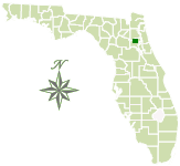
Etoniah Creek State Forest is located in northern Putnam County in northeast Florida. The forest headquarters is located northeast of Florahome. From Florahome, go 2 miles east to Holloway Road. Go north on Holloway Road 2.6 miles to Fieldhouse Road. The office is half a mile down Fieldhouse Road.
Total Acreage: 8,902
Counties: Putnam
Smart device mapping is possible and encouraged in the State Forests. Before visiting a forest, search for “PDF Maps” in the app store to find an app that works for you and download our State Forest map, which is georeferenced.
 589.1 kB
]
332 kB
]
789.8 kB
]
22.8 MB
]
589.1 kB
]
332 kB
]
789.8 kB
]
22.8 MB
]
The Florida National Scenic Trail passes through the forest.
Contact:
Amelia McKnight
Waccasassa Forestry Center
Amelia.McKnight@FDACS.gov
