About Charles H. Bronson State Forest
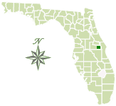
On July 1, 2008, the Charles H. Bronson State Forest was established by legislative direction and is named after Charles H. Bronson, who served as the ninth Commissioner for the Florida Department of Agriculture and Consumer Services from 2001 to 2011. The forest is approximately 11,246 acres. It was purchased by the Board of Trustees (Florida Forever Funds), St. Johns River Water Management District, Natural Resource Conservation Service and Orange County.
In the past, the forest was used for turpentine, agriculture and cattle grazing. Today it is managed to restore and maintain native ecosystems, protect plants and animals, protect archaeological and historical sites, support outdoor recreation, and protect the quality and health of rivers and wetlands. Sustainable forest management and agricultural management practices are used.
Prescribed fire is applied to mimic natural fires and helps to reduce the hazards of wildfires. It is used as an effective tool to improve forest health, ecological functions and wildlife habitat.
Natural Features
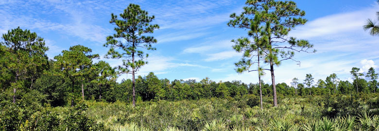
The forest provides a crucial source of protection for wetlands and associated natural communities within the floodplain of the St. Johns River. Other natural communities include wet prairie, pine flatwoods, sandhill and cypress swamp.
The Charles H. Bronson State Forest’s most notable feature is the St. Johns River, which makes up part of the forest’s eastern boundary. It is designated as an American Heritage River and, at 310 miles, is the longest river in Florida. Other notable features of the forest include the four creeks that flow through it: Turkey Creek, Joshua Creek, Buscombe Creek and Christmas Creek.
The forest supports a variety of wildlife, including deer, turkey, gray squirrel, alligator, southern fox squirrel, gopher tortoise, bald eagle, roseate spoonbill, sandhill crane and wood stork.
Recreation
The forest is open during daylight hours for visitors to enjoy picnicking, horseback riding, hiking, fishing and wildlife viewing. Access to the trails is available at one main trailhead at the end of Phillips Road and a shared trailhead at the Chuluota Wilderness Area at the end of Curryville Road.
Seasonal hunting takes place in the forest. See the hunting section for dates.
Horse Trail
The Charles H. Bronson State Forest has 20 miles of horse trails that are connected to three other conservation lands along its boundary — Little Big Econ State Forest, Chuluota Wilderness Area and Orlando Wetlands Park. As you ride along the trails you will go through a variety of ecosystems such as sandhill, pine flatwoods and oak-palm hammocks. You will also pass the freshwater marsh that borders the St. Johns River. Some sections of the trail also go along the edges of cattle pastures.
The Charles H. Bronson State Forest has designated a 4.7-mile loop trail that is included in the Trailtrotter Program.
NOTE: ALL horses must have proof of current negative Coggins Test results when on state lands. ALL children under the age of 16 are required to wear a protective helmet while riding on state lands.
-
Horse Trail Map
[
 335.7 kB
]
335.7 kB
]
Hiking Trails
The Charles H. Bronson State Forest has 18.7 miles of hiking trails, of which 7.1 miles are the Florida National Scenic Trail. The trails lead hikers through a variety of ecosystems, including the majestic oak-palm hammocks, pine flatwoods and sandhill. The trails provide many scenic views and a chance to see some wildlife along the way.
The Charles H. Bronson State Forest has also designated a 9.5-mile loop trail that is included in the Trailwalker Hiking Program.
The hiking trails are maintained by the Florida Trail Association.
-
Hiking Trail Map
[
357 kB
]
Primitive Camping
The Charles H. Bronson State Forest offers primitive campsites located on the Joshua Creek Tract. Overnight parking for camping is located at the Joshua Creek Trailhead at the end of Phillips Road. The primitive campsites can only be accessed from the hiking trail.
To reserve a campsite, visit Charles H. Bronson State Forest Primitive Camping.
-
Joshua Creek Campsites Map
[
212.3 kB
]
Hunting and Fishing
Hunting and fishing in the Charles H. Bronson State Forest are regulated by the Florida Fish and Wildlife Conservation Commission.
The Charles H. Bronson State Forest is open for hunting and is a Wildlife Management Area that is managed cooperatively by the Florida Forest Service and the Florida Fish and Wildlife Conservation Commission. Check the Charles H. Bronson Wildlife Management Area Hunting Brochure for dates. Wildlife hunted in the forest includes deer, ducks, hogs, rabbits, squirrels and turkeys.
Fishing is a popular activity along the St. Johns River, where largemouth bass, catfish, crappie, bluegill and other fish are frequently caught.
In keeping with its mission to protect and manage Florida's forest resources, the Florida Forest Service has developed rules that apply to all State Forest visitors. Find out more about State Forest fees and rules.