Biking

Camping

Fishing

Hiking

Horseback Riding

Seasonal Hunting

OHV Riding

Paddling
The natural resources found in Tate's Hell State Forest are very diverse due to the unique and various natural community types. At one time Tate's Hell State Forest supported at least 18 major community types, which included mesic flatwoods, wet flatwoods, wet prairie, dome swamp, shrub bog, basin swamp, baygall, depression marsh, floodplain marsh, scrubby flatwoods, sandhill, floodplain marsh, scrubby flatwoods, sandhill, floodplain swamp, scrub, blackwater stream, bottomland forest, basin marsh, swamp lake, sandhill upland lake. Currently, the forest contains approximately 107,300 acres of hydric communities such as wet prairie (which contains a vast diversity of plant species), wet flatwoods, strand swamp, bottomland forest, baygall and floodplain swamp. Past management practices have disrupted the function of the natural ecosystems on Tate's Hell State Forest. The restoration of these ecosystems is a primary objective of the Florida Forest Service.
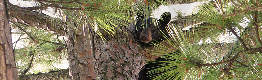
Many species of wildlife make their home in the forest, including such rare species as the bald eagle, Florida black bear, gopher tortoise and red-cockaded woodpecker. Rare plant species include thick-leaved water-willow (Justicia crassifolia), white birds-in-a-nest (Macbridea alba), Florida bear grass (Nolina atopocarpa), Chapman's butterwort (Pinguicula planifolia) and small-flowered meadow beauty (Rhexia parviflora).
The predominant hydrologic feature within the forest is Tate's Hell Swamp, which drains toward the Apalachicola River and Bay. The river and bay are designated as Outstanding Florida Waters and are the highest priority water bodies under the Northwest Florida Water Management District's SWIM Program. The Apalachicola River is designated for recreation and propagation and maintenance of a healthy, well-balanced population of fish and wildlife.
Tate's Hell State Forest is home to several stands of dwarf cypress, also known as "miniature" or "hat-rack" cypress. Although some of the trees are over 300 years old, none are taller than about 15 feet. The Ralph G. Kendrick Boardwalk offers an observation tower overlooking one of the areas where these dwarf cypress trees grow most prolifically.
Apalachicola Bay is a State Aquatic Preserve with designated uses such as shellfish propagation and harvesting. Tate's Hell Swamp plays an important role in the function of the marshes in the upper bays south of the forest that serve as nursery areas for Apalachicola Bay. The Tate's Hell Swamp tributaries to East Bay include Cash Creek, High Bluff Creek, Rake Creek, Whiskey George Creek, Juniper Creek and Doyle Creek. The New, Ochlockonee and Crooked rivers are the major rivers that adjoin the State Forest. Numerous other creeks flow through the forest, including such named creeks as Alligator, Bear, Cow, Deer, Fish, Gully Branch, Graham, Sunday Rollaway, Pine Log, Roberts, Sanborn, Sandbank, Trout, Womack and two Juniper creeks.
A tale that has been told for many years recounts how Tate's Hell Swamp got its name. Local legend has it that a farmer by the name of Cebe Tate, armed with only a shotgun and accompanied by his hunting dogs, journeyed into the swamp in search of a panther that was killing his livestock. Although there are several versions of this story, the most common describes Tate as being lost in the swamp for seven days and nights, bitten by a snake, and drinking from the murky waters to curb his thirst. Finally he came to a clearing near Carrabelle, living only long enough to murmur the words, "My name is Cebe Tate, and I just came from Hell." Cebe Tate's adventure took place in 1875 and ever since, the area has been known as Tate's Hell, the legendary and forbidden swamp.
Tate's Hell State Forest offers a variety of recreation activities for the outdoor enthusiast. There are 35 miles of rivers, streams and creeks available for canoeing, boating and fishing. A concrete boat launch site is located at Cash Creek, with additional launch sites available at locations throughout the forest. Fishing requires a valid license and is regulated under the direction of the Florida Fish and Wildlife Conservation Commission (FWC). Picnicking at one of the many day-use areas is a popular activity in the forest.
Horseback riding is also available. While riding our trails, please note that proof of current negative Coggins test is required for all horses in all Florida State Forests.
Primitive campsites are dispersed throughout the forest. Most sites are on the riverbanks with canoe/kayak/small boat access and fishing.
The entire State Forest is a Wildlife Management Area and is open to regulated hunting under the direction of the FWC. Special permits that allow hunt camps for the duration of the hunting season are also available for a fee. Visit the FWC website for information.
In keeping with its mission to protect and manage Florida's forest resources, the Florida Forest Service has developed rules that apply to all State Forest visitors. Find out more about State Forest fees and rules.
2026-2027 Open Hunt Camp Sales Registration and Random Draw
Registration for the Open Hunt Camp season reservation drawing will open on Friday, August 28, 2026, at 10 a.m. at the Tate’s Hell State Forest Headquarters Conference Room, 290 Airport Road, Carrabelle, FL 32322. Must be in person and have a valid hunting license to enter the drawing. After the winners are selected, instructions will be provided for payment on Reserve America. If you have questions or concerns regarding this drawing process, please contact Clint Davis, Tate’s Hell State Forest Operations Administrator, at (850) 697-0010 or email Clint.Davis@FDACS.gov.
Day use is from sunrise to sunset.
Tate's Hell State Forest
290 Airport Road
Carrabelle, FL 32322-3059
(850) 697-0010 — Carrabelle Office
(850) 681-5963 — Tallahassee Field Office
Email Tate's Hell State Forest
Passes are no longer available at the State Forest office. To purchase a pass or make a reservation, visit ReserveAmerica or call 1-877-879-3859.
Tate's Hell State Forest is located in Franklin County, between the Apalachicola and Ochlockonee rivers. The forest extends into the southeast corner of Liberty County, south of the Apalachicola National Forest and 1.5 miles northwest of the town of Carrabelle. Access Tate's Hell State Forest from U.S. Highway 98, County Road 67, State Highway 65 or State Highway 319.
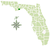
Total Acreage: 212,645
Counties: Franklin, Liberty
Smart device mapping is possible and encouraged in the State Forests. Before visiting a forest, search for “PDF Maps” in the app store to find an app that works for you and download our State Forest map, which is georeferenced.
 13.3 MB
]
1.7 MB
]
338.4 kB
]
14.6 kB
]
13.3 MB
]
1.7 MB
]
338.4 kB
]
14.6 kB
]
Resources:
564 kB
]
6.7 MB
]
1 MB
]
23.7 MB
]
Video:
High Bluff Coastal Hiking Trail
[
338.4 kB
]
(map) is part of the Florida Forest Service's Trailwalker Hiking Program.

This State Forest is part of the Great Florida Birding Trail.
Contact:
Jai Subramanya
Jai.Subramanya@FDACS.gov