
Biking

Camping

Fishing

Hiking

Horseback Riding

Seasonal Hunting

Paddling
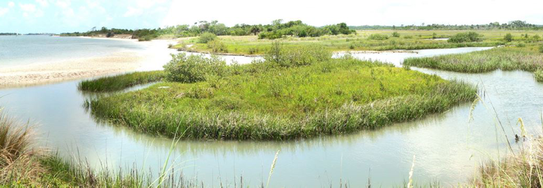
Matanzas State Forest is part of a 16,000-acre continuous conservation corridor beginning with Moses Creek (managed by the St. Johns River Water Management District) and continuing south through the forest into Faver-Dykes State Park (managed by the Florida Department of Environmental Protection), Pellicer Creek Conservation Area and Flagler County’s Princess Place Preserve.
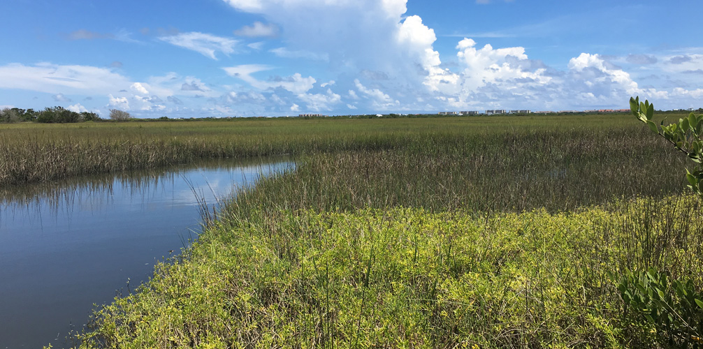
The forest is home to songbirds, wading marsh birds, bald eagles, deer, otter, turkey, hogs and gopher tortoises.
About 75% of the forest is upland and made up of pine plantations. The remaining 25% of the forest is wetlands, including bay and cypress swamps. Slash and longleaf pines dominate the upland forest. Most of the pine stands range in age from about 15 to 30 years old.
There is an archaeological record of possible Native American settlements in the area. Historic features include remains from turpentine camps. More recently, timber companies and hunt clubs shared the land that is now the forest.
Recreational features include roads for horseback riding, hiking and bicycling; water access for canoeing and fishing; and abundant wildlife and diverse ecosystems for nature study, viewing and photography. Camping is available at the Cedar Creek Campground, and youth groups are welcome at the Matanzas Group Camp.
The two hiking trails Matanzas State Forest offers, the Flatwoods Loop (2.4 miles) and the Hammock Hiking Trail (3.1 miles), are Trailwalker trails. Learn more about the Trailwalker Program.
The Florida Forest Service began managing this parcel in 2003. We are currently making improvements to the forest so that visitors can take full advantage of all it has to offer.
Hunting requires a license and permit and is allowed only in Matanzas Wildlife Management Area during appropriate seasons. Visit the Florida Fish and Wildlife Conservation Commission (FWC) website for licenses and permit information for hunting and fishing.
In keeping with its mission to protect and manage Florida's forest resources, the Florida Forest Service has developed rules that apply to all State Forest visitors. Find out more about State Forest fees and rules.
Note: Proof of current negative Coggins test is required for all horses in all Florida State Forests.
Day use is from sunrise to sunset.
Matanzas State Forest
6840 U.S. Highway 1 South
St. Augustine, FL 32086
(904) 797-5073
Email Matanzas State Forest
Passes are no longer available at the State Forest office. To purchase a pass or make a reservation, visit ReserveAmerica or call 1-877-879-3859.
Located in St. Johns County, Matanzas State Forest is owned by the state of Florida and managed by the Florida Forest Service in cooperation with the Florida Fish and Wildlife Conservation Commission and St. Johns River Water Management District.
Situated north of Faver-Dykes State Park and south of Moses Creek Conservation Area, the forest is bounded on the west by U.S. Highway 1 and the east by the Intracoastal Waterway (Matanzas River).
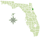
Total Acreage: 4,699
Counties: St. Johns County
Smart device mapping is possible and encouraged in the State Forests. Before visiting a forest, search for “PDF Maps” in the app store to find an app that works for you and download our State Forest map, which is georeferenced.
 358.1 kB
]
8.2 MB
]
27.4 MB
]
358.1 kB
]
358.1 kB
]
8.2 MB
]
27.4 MB
]
358.1 kB
]
Matanzas State Forest is part of the Great Florida Birding and Wildlife Trail.
Justin Rogers
Justin.Rogers@FDACS.gov