Recreation Tracts: Anderson Springs | Black | Blue Springs Longleaf | Chitty Bend East | Chitty Bend West | Damascus | Deese | Ellaville | Mill Creek South | Mill Creek North | Nekoosa | Sullivan | Westwood East | Westwood West | Withlacoochee
Twin Rivers Wildlife Management Area
Many of the tracts on Twin Rivers State Forest are included in the Twin Rivers Wildlife Management Area, and hunting is allowed. Be sure to check the hunt dates when planning your recreational activities.
Anderson Springs Recreation Area
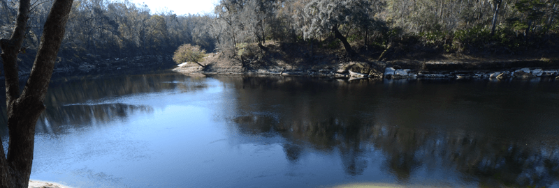
The Anderson Springs Tract is 1,427 acres of mostly bottomland forest along the eastern bank of the Suwannee River. The tract includes Anderson Springs, a popular day-use recreation area with a boardwalk located off the north entrance on River Road.
There is a primitive group camping site on the river. A small parking area on the southern end of the tract provides fishing access to the river. No overnight parking is permitted on the Anderson Springs Tract.
Trails
The day-use area serves as the trailhead for a designated Trailwalker hiking trail and mountain biking trail. The first 2.7 miles of trail is a shared trail blazed yellow and blue for hiking/biking. The hiker return loop is blazed yellow for an additional 2.3 miles. The return loop for bikers is blazed blue and takes you through bottomland forest for another 3.4 miles.
Directions
Travel 13 miles west on U.S. Highway 90 from Live Oak to River Road (Suwannee County) and turn left. Travel south 2.7 miles, crossing over Interstate 10. The entrance is at the foot of the overpass on the right.
Black Recreation Area
The Black Tract is 633 acres of mostly pine forest along the western bank of the Suwannee River. There is a large parking area located off Southeast River Road for public access. A primitive group camping site is located on the river and is available to hikers and paddlers.
Trails
The parking area serves as a trailhead for a 5-mile horse trail and 3.1-mile hiking trail. The Florida National Scenic Trail also traverses the Black Tract.
Directions
Travel 14.7 miles west on U.S. Highway 90 from Live Oak to Southeast River Road in Madison County. Turn left and travel south 3.6 miles. The entrance is on the left.
Blue Springs Longleaf Recreation Area
The Blue Springs Longleaf Tract is 2,095 acres of intact upland pine community composed of old-growth longleaf pine.
Trails
There are two designated equestrian trails on the Blue Springs Longleaf Tract. The Trailtrotter horse trail (blazed in blue) and the Auxiliary horse trail (blazed in orange), combined, provide 12 miles of riding pleasure. All other roads and firebreaks are available for biking and hiking only.
Directions
From Interstate 75, Exit 460 (Jasper/Madison), drive 9.8 miles west on Highway 6. Entrance is on the right.
Chitty Bend East Recreation Area
The Chitty Bend East Tract is 273 acres of mostly pine forest along the eastern bank of the Withlacoochee River in Hamilton County. There is a primitive campsite on the river available for overnight camping by paddlers and hikers. Fishing is also available at the primitive campsite. Vehicle accessibility on this tract is limited during inclement weather. Overnight vehicle parking is not permitted.
Trails
There are no designated trails on the Chitty Bend East Tract, but roads and firebreaks may be used for hiking, biking and horseback riding.
Directions
From Interstate 75 north of Lake City, Exit 460 (Jasper/Madison), travel west on State Road 6 for 10.6 miles. Turn right on NW County Road 143 and travel north 2 miles. Turn left on NW 23rd Boulevard and travel north 1 mile. Turn left on NW 34th Street and travel 2 miles. The entrance is on the left.
Chitty Bend West Recreation Area
The Chitty Bend West Tract is 528 acres of mostly pine forest along the western bank of the Withlacoochee River in Madison County. There is a recreational area with river access on the south end of the tract. Overnight vehicle parking is not permitted.
Trails
There are no designated trails on the Chitty Bend West Tract, but roads and firebreaks may be used for hiking, biking and horseback riding.
Directions
From Interstate 75 north of Lake City, Exit 460 (Jasper/Madison), travel west on State Road 6 for 13.6 miles and turn right on Old Blue Springs Road. Travel 3.25 miles north and turn right on NE Cottonwood Street. The tract is at the end of the road.
Damascus Recreation Area
The Damascus Tract is 599 acres of mostly longleaf pine forest along the western bank of the Suwannee River in Madison County. The tract is accessible from SE River Road by vehicle, the Florida Trail or the Suwannee River.
Trails
- Florida National Scenic Trail
Directions
Travel 14.7 miles west on U.S. Highway 90 from Live Oak to SE River Road in Madison County. Turn left and travel south approximately 3 miles. The gate is on the left.
Deese Recreation Area
The Deese Tract is a narrow, linear, east-west oriented tract located on NW 16th Avenue in Hamilton County along the eastern bank of the Withlacoochee River. It consists of 101 acres of natural longleaf pine sandhill and bottomland forest communities. This tract provides a river access point for fishing.
Trails
There are no designated trails on the Deese Tract, but roads and firebreaks may be used for hiking, biking and horseback riding.
Directions
From Interstate 75, Exit 467 (Jennings), take County Road 143 south to County Road 152. Travel west 11 miles, turn left and travel west on County Road 150 (NW 13th Drive) for approximately 1,800 feet. Turn right on NW 16th Avenue. The entrance is approximately 4,000 feet on the left.
Ellaville Recreation Area
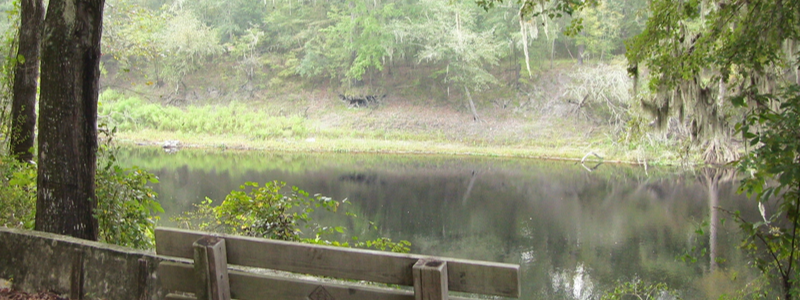
The Ellaville Tract is 4,198 acres of upland and bottomland pine forest along the western bank of the Suwannee River. The Ellaville Tract is on U.S. Highway 90 in Madison County along the western banks of the Withlacoochee and Suwannee rivers near their confluence.
Currently, there are two public access points to the Withlacoochee River and two public access points to the Suwannee River. Most of these have picnic facilities.
There are primitive group camping sites on the river available to hikers and river traffic. Group camping requires a permit obtainable by calling (386) 339-6472 or emailing Jason.Nastovski@FDACS.gov.
Trails
- Florida National Scenic Trail
- Hiking trail: Full loop is 5 miles; Trailwalker Shortcut is 3 miles.
- There are no other designated trails on this tract, but roads and firebreaks may be used for hiking, biking and horseback riding.
Directions
- To Myrrh Road recreational site: Travel 15.3 miles west on U.S. Highway 90 from Live Oak to Myrrh Road (County Road 141). Turn right and travel north approximately 1.5 miles. Entrance is on the left.
- To Central Ellaville Avenue recreational site: Travel 13.4 miles west on U.S. Highway 90 from Live Oak to Drew Way. Turn right and travel approximately 200 feet. Turn left onto Central Ellaville Avenue. Travel 0.5 miles. The entrance is on the right.
- To Trailwalker trailhead: Travel 13.5 miles west on U.S. Highway 90 from Live Oak to Trailwalker trailhead on the south side of the highway.
- To southern recreational site: Travel 14.7 miles west on U.S. Highway 90 from Live Oak to SE River Road in Madison County. Turn left; travel south approximately 2 miles and the entrance is on the left.
Mill Creek South Recreation Area
The Mill Creek South Tract is the southernmost tract on Twin Rivers State Forest. It is 1,387 acres of upland forest, bottomland forest and floodplain swamp along the western bank of the Suwannee River in Madison County. Road B off of SE Boundary Bend Trail provides public access to the tract and leads to several parking areas, including one at the river.
Trails
There are no designated trails on this tract, but roads and firebreaks may be used for hiking, biking and horseback riding.
Directions
Travel 14.7 miles west on U.S. Highway 90 from Live Oak to SE River Road in Madison County. Turn left. Travel south 9 miles and turn left on SE Waccamaw Avenue. Travel 100 feet and turn left onto SE Boundary Bend Trail. Travel east approximately 1.25 miles and the entrance is on the left.
Mill Creek North Recreation Area
The Mill Creek North Tract is 654 acres of bottomland forest along the western bank of the Suwannee River. Road A off SE River Road provides public access to several parking areas and to the river for picnicking and fishing.
Trails
The Florida National Scenic Trail enters the southern portion of the state forest on the Mill Creek North Tract. Roads and firebreaks may be used for hiking, biking and horseback riding.
Directions
Travel 14.7 miles west on U.S. Highway 90 from Live Oak to SE River Road in Madison County. Turn left and travel south 6 miles. The entrance is on the left.
Nekoosa Recreation Area
The Nekoosa Tract is 524 acres of upland and bottomland forest.
Trails
There are no designated trails on the Nekoosa Tract, but the property is open to hiking if accessed from the river.
Directions
There are no open land-based public access points from the road.
Sullivan Recreation Area
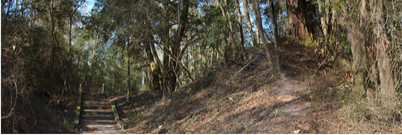
The Sullivan Tract consists of 378 acres of upland pine and bottomland forest along the western bank of the Withlacoochee River. A public road provides access to the recreational area on the northeast corner of the tract for picnicking and fishing. This site also provides access to the river. Overnight vehicle parking is not available in this location.
On the southern side of County Road 150, a day-use parking area allows access to the river for fishing and canoe/kayak launch.
Trails
There are no designated trails on the Sullivan Tract.
Directions
From Interstate 75, Exit 467, travel west on NW County Road 143 approximately 3 miles. Turn right and travel 6.6 miles northwest on NW County Road 152 to NW County Road 150 (aka Bellville Road or NW 13th Drive). Travel west 0.5 miles to the north and south entrances of the Sullivan Tract.
Westwood East Recreation Area
The Westwood East Tract is 569 acres of sandhill, upland pine and bottomland forest along the east side of the Withlacoochee River.
Trails
There are no designated trails on this tract, but the property is open to hiking if accessed from the river.
Directions
There are no open land-based public access points from the road.
Westwood West Recreation Area
The Westwood West Tract consists of 505 acres of upland pine and bottomland forest along the western bank of the Withlacoochee River. A public road provides access to a day-use parking area for picnicking and fishing.
Trails
There are no designated trails on the Westwood West Tract.
Directions
Exit west from Interstate 75 at Jennings, Exit 467, and travel west on NW County Road 143 approximately 3 miles. Turn right and travel 6.6 miles west on NW County Road 152 to NW County Road 150 (aka Bellville Road or NW 13th Drive). Travel west 2 miles and turn left. Travel south on Hickory Grove Road (aka NE 155th Street) for 1 mile. Entrance is on the left (east) side of the road.
Withlacoochee Recreation Area
The Withlacoochee Tract, locally known as the Pot Springs Tract, is 1,156 acres of upland and bottomland pine forest along the eastern bank of the Withlacoochee River. Pot Springs, nestled on the riverbank, is a popular day-use recreation area. Additionally, there is a primitive campsite on the river available for overnight camping by paddlers.
Trails
The Withlacoochee Tract features a 7-mile horseback riding trail.
Directions
From Interstate 75, travel west 11 miles on State Road 6. Turn left on SW 28th Lane and the entrance is 0.5 miles on the right.