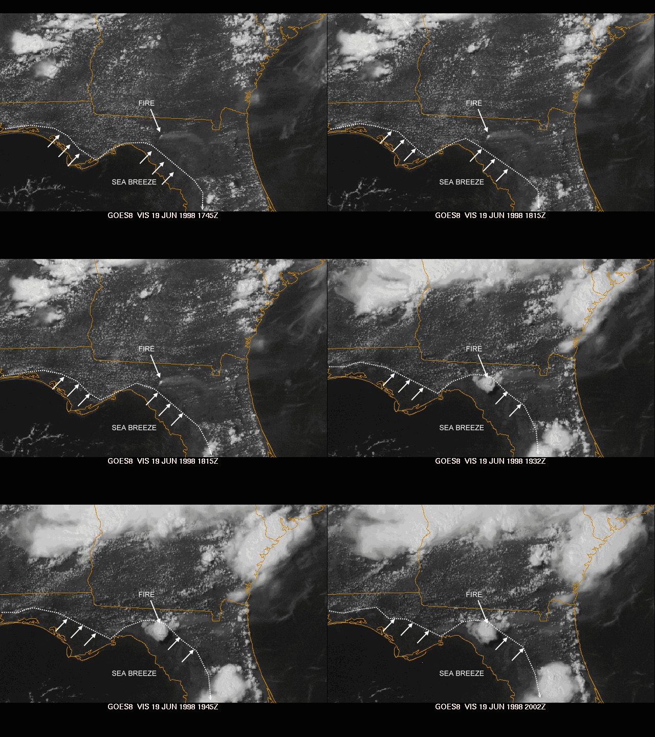
During the day on June 19, 1998, as on many late spring days, a sea breeze front moved inland from the Gulf coast across the Florida Panhandle and coastal bend. The cooler, relatively stable marine air behind the front was almost cloud-free, while thousands of small cumulus clouds prevailed along the front and farther inland. Sea breeze fronts often explode with thunderstorms, as vertical circulations along them lift hot and moist air upward through weak capping inversions. During this day, however, the air mass was too capped for thunderstorms along this part of the sea breeze front -- everywhere but over an intense forest fire (called the Perry Fire) in Lafayette County, Florida, near the town of Mayo. The above sequence of images span roughly a 2 hour time period.
As the sea breeze front passed over the fire, the rising motion of the hot air off the fire combined with lift along the front; and a thunderstorm erupted. Instead of aiding fire fighters with heavy rain, such storms can actually hamper fire suppression efforts by producing strong downdrafts, erratic winds, and additional lightning-started fires. In Florida, the ground and vegetation had been badly desiccated after months of scant rainfall, making conditions ideal for wildfires to start and spread.
Thanks to Greg Carbin of NOAA's Storm Prediction Center for providing the images, animation and most of the information on this event.