View Prior Notification Registry Map
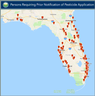
The map shows the names, addresses, property boundaries, and buffers for Florida citizens who have registered as chemically sensitive and need prior notification for the application of pesticides. This map is updated real-time as registrants are added, removed or amended on the list.
You may navigate to the top right corner of the map header to search by county or a registrant’s name. You can also pan to an area on the map by scrolling to zoom in or out.
To generate a report of all data, or filtered data, navigate to the bottom right-hand corner of the screen and select the downward arrow button to download the report. It will generate in an Excel format. Ensure you do not have popups blocked on your device. Check your Downloads folder if you do not see where the report saved.
Additional tools have been made available in the top right corner of the map: Legend, Layers and Basemaps.